
- This event has passed.
JAVEA – Golfclub Around the paths and woods of Ladoga / Las Laderas – Thur
Thu 11 December, 2025 @ 10:00 – 11:00
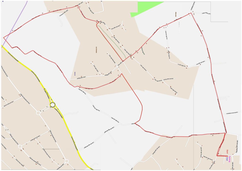
| Meeting Point | CALLE LAGO TANGANYKA parking area. GPS: 38°45’07.1″N 0°09’47.4″E | ||
| Walking Route | Distance : 4,5 km | Around the woods and tracks of the Ladoga and Las Laderas area. | |
| Terrain | Walking Surface | Some tarmac roads, many compacted dirt paths (some rough). | |
| Ascent | Some modest climbs, nothing severe. | ||
| Directions to Meeting Point | From Moraira: Drive to Benitachell and turn right at the traffic lights. Go straight on at the next lights. After passing the large furniture store (Devygar Mobles) turn right. Take the 2nd exit at the next roundabout and go past the entrance to Cansalades Park on the right. After 400m there is a junction where the main road bends to the right, but you need to turn LEFT in front of the large concrete sign LAS LADERAS, into Calle Lago Como. From Jávea: From the Mas y Mas supermarket, take the road towards Benitachell up the hill. 600 metres after passing the Inn on the Green bowls club, the road bends left at the old El Campo restaurant. There are two roads on the right hand side as the road bends left. Take the second of these two roads Calle Lago Como; do not take the road immediately alongside the restaurant. Drive past the parking area on the right, up to the top of the hill and round the right hand bend. Then take the first left into CALLE LAGO VANERN and then bear right into CALLE LAGO TANGANYKA. Park here. | ||
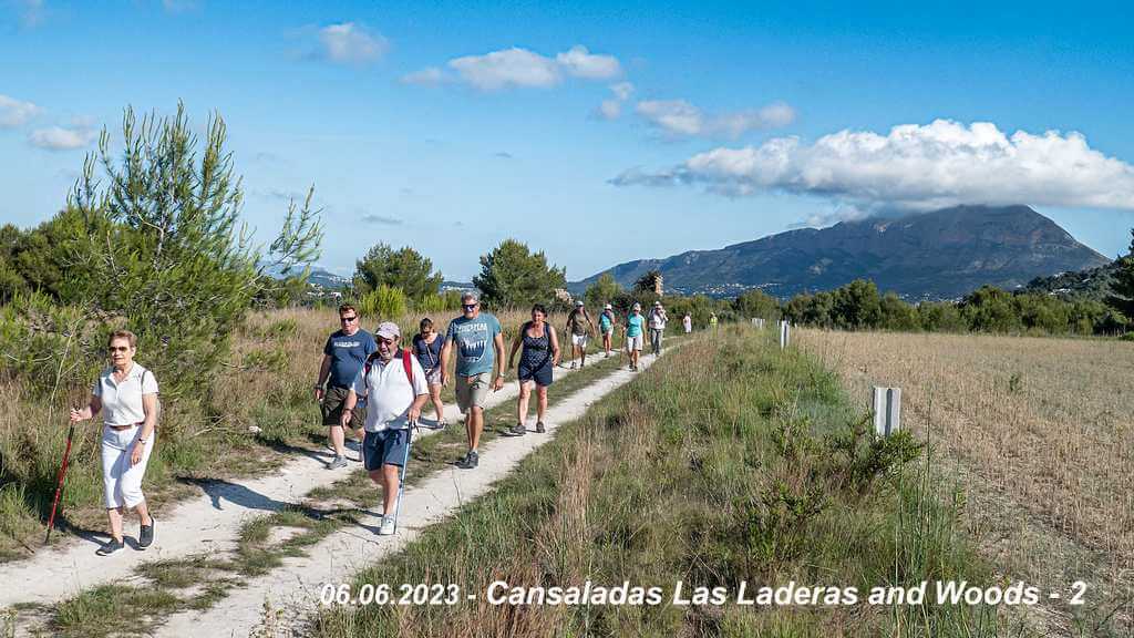
Walk Description
- Walk towards Calle Lago Como, this is continue from where you came with the car. Turn left and walk to the junction of carrer lago aral and cami de la sabatera.
- Continue here on Cami de la Sabatera. which is a narrow tarmac road that goes downhill. You need to be aware of traffic, although the road isn’t busy. The gradient eases off after ½ km, and although there are one or two house it is mostly fields on either side of the road.
- After ¾ km (from Aral), as you approach some houses (ahead, slightly right), you need to look for a narrow dirt path on your left. [The road bends slightly right at the point where the path is and there is another path, to the
right, almost opposite, going towards a house with arches.] Turn left, ignoring the side track to the right, and walk down this narrow straight dirt path. - This path has fields on either side, passes a couple of ruined small casitas and the golf club is visible across the fields to the right after a while. You are now walking along Lago Eire, which eventually passes a house as it
becomes a road. Walk on to the crossroads with Lago Saimaa. - At the crossroads, go straight across and take the second path on the right into the woods. [There are two tracks running through these woods both parallel to Calle Lago Saimaa and both emerge at the same point.
Your choice, but the second one is considered nicer.] - Walk through the woods, with an open area sometimes on the left . At the end, turn right and shortly (20m) you will reach a T-junction with Lago Saimaa. Turn left onto this very wide road, and around the bend
- Walk down Calle Lago Saimaa towards the T-junction with Ladoga. Turn left and follow the tarmac road. Continue straight on when the tarmac gives way to gravel/dirt.
- Just before the gravel road reaches the main Cansalades road, there is a turning on the left, Calle de Lago Aral.
Turn left here into Lago Aral. - 80m later, Lago Aral turns left off the tarmac onto a rough wide track. Lago Aral dog-legs right, left and right again up a slight hill, before it goes into the edge of a wooded area. There are views to your right of the north
side of Cumbre del Sol and all the boxy houses built there. - The wooded area on the left ends and the track goes alongside a wooded area on the right. After passing a wide track on the left going to a house (Lago Baljash on the map), our track enters another wooded area.
- Just before the end of the wooded area is a short track on the left. Go up this track, walk round the chain and turn right towards the road. You are now on Lago Yojoa. You will pass houses on both sides.
- When Lago Yojoa turns left, you should turn right onto a wide but rough track going downhill to start with and then uphill to pass between two stable ar eas normally stocked with many horses.
- This track bears right before it meets Lago Aral again at a T-junction. Turn left here.
- As you walk along Lago Aral there are great views of Montgó in the distance to your left until the track enters another wooded area. The track is rough and uneven here.
- When Lago Balatón joins Lago Aral (from right) then the track becomes a tarmac road. Stay on Lago Aral as it passes houses on both sides, climbing the hill until reaching a sort of crossroads.
- Turn right into Calle Lago Como which is a tarmac road. Walk up till the next road on the left. Turn left into CALLE LAGO TANGANYKA where your car is parked