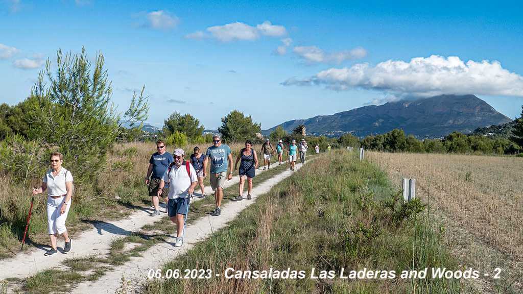

JAVEA – Cansaladas Las Laderas urb. and woods -2 (Thu)
April 16 @ 10:00 – 11:00
Walk leaders: Gill & George
| Meeting Point | Cami Lago Como of cami de les Cansaladas CV-747 before El Campo Restaurant,left in Cami Lago Como near Mailboxes of Las Laderas urb. GPS: 38°45’00.4″N 0°10’08.3″E Use View Venue Website below for precise location. | ||
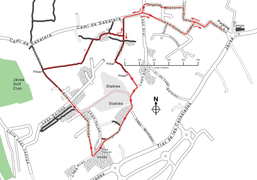
| Walking Route | Distance : 5 km | Through Las Laderas urbanisation into the woods and around the rear of the Jávea Golf club. | |
| Terrain | Walking Surface | Some roads but mostly good tracks and paths | |
| Ascent | Mostly flat but starts with a fairly steep climb through the urbanisation. (Ascent 105m). | ||
| Directions to Meeting Point | From Moraira: Drive through Benitachell towards Javea. Pass the football field on the right and take the first road to the right CV-747 towards Javea arenal. Pass the roundabout, go straight and follow the road until it bends to the right. At this point turn left into Lago Como. do not take the road immediately alongside the restaurant. Parking near the mailboxes.. From Jávea: At Barclays Bank, take the road towards Benitachell up the hill. 600 metres after passing the Inn on the Green bowls club, the road bends left at the old El Campo restaurant. There are two roads on the right hand side as the road bends left. Take the second of these two roads; do not take the road immediately alongside the restaurant. Parking near the mailboxes. | ||
Walk Description
- Walk up the hill of Calle del Lago Como following it round to the left and right. Do NOT take the next turning on the left (Lago Como) but continue straight on up the hill into Lago Cinebra.
- Follow it around to the right and then take the first turning on the left, Calle Lago Vanern.
- The road wiggles as it joins Lago Tanganyka, keep going straight on. At the T-junction with Cami de Sabatera, turn left, and, at the crossroads, turn right to stay on Cami de Sabatera.
- Cami de Sabatera can be busy at times, so beware. After a short distance (approx 130m), just before some trees, there is a dirt path on the left going across some fields towards a wooded area. [If you reach a chain entrance on Sabatera then you have gone about 80m too far].
- Walk along this straight dirt path, it bends slightly to the right and then enters the trees. Keep going straight until you reach a ruined finca. Turn left at the finca and follow the path through the grass. The path can be difficult to see in the grass, but it goes almost in a straight line.
- The path then curves slightly left as it rises and joins a cart track at another ruined finca (on your right). The cart track T-junctions with a rough whitish road where you should turn right into Lago Aral. Notice the magnificent view of Montgó on your right.
- When the track approaches some stables, turn left and curve right around the stables (still on Lago Aral). [There are alternative routes marked on the map.] Ignore the turning (Lago Michigan) to the left. Continue along Lago Aral until the track goes into a wooded “tunnel”.
- At the other end of the “tunnel”, take the track on the right. This is Calle Lago Baljas (often marked on maps as Baljash). Walk along this track past a new house on the left and then the track becomes a tarmac-ed road. The stables are just visible to the right through the fence.
- Walk straight over the next two crossroads (first with Lago Yojoa and then with Lago Saimaa) and into Calle de Lago Eire. This road very quickly becomes a narrow dirt path (ignore the track to the left) and runs along the back of the Jávea Golf Club.
- Look for a ruined finca on your left, very close to the path. About 10m after the finca, on your right, is a narrow dirt path leading across the fields. Follow this path in an almost straight line for about 250m. The path then curves to the left through some trees and then out in the open.
- It goes along a terrace and then junctions with another path, where you should go up the slope then follow the path as it curves to the left into some more trees. Proceed the ends of the two walls. It emerges into a clearing under some electricity pylons. Go straight across the clearing towards a small wall. There is a path to the left but you should take the path to the right, up a slight slope and left around some small trees. This path runs alongside some trees to your right.
- When you reach a junction with another path, turn left and soon you will reach Cami de Sabatera. Turn right and carefully walk the short distance up the hill.
- At the top of the hill, go straight across and into Lago Como. This rough track quickly becomes a road as it descends steeply. Go down the hill ignoring the side turnings. Notice the abundance of traffic furniture and zebras grazing on every corner!
- Take the last turning on the left (still Lago Como) then turn right to return to the parking area.
Interested ? Add this event to your calendar using the button below